|
Updated: @
29-Jul-2026 1:35am - next update at 1:40am
|
| Summary / Temperature |
Wind |
Rain |
Outlook |

|
overcast mist
|

|
69.3°F

Comfortable
Feels like:
61.4°F
24-hr difference
-0.9°F |
| |
Today |
Yesterday |
| High: |
69.8°F
12:00am
|
89.8°F
3:22pm |
| Low: |
69.3°F
1:02am
|
69.4°F
7:09am |
|
|


|
SE
0
Gust:
0 mph
|
|
0 Bft -
Calm
|
|
Today:
2.3 mph
12:20am
|
|
Gust Month: 11.4 mph
July 10
|
|
Windrun Today:
|
|
| Rain Today: |
0 in
|
| Rain Rate (/hr): |
0 in
|
| Rain Yesterday: |
1.46 in
|
| Last 7 Days Rain: |
2.20 in |
| This Month: |
5 in
|
| Year Total: |
31.4 in
|
|
19 rain days in July. |
|
Tomorrow

Partly Cloudy |
|
| Humidity & Barometer |
Almanac |
Moon |
| Humidity: |
99 %
|
| Dew Point: |
69°F
|
| Barometer: |
29.71 inHg
|
| Baro Trend: |
Steady
|
|
| Sunrise: |
6:44am |
| Sunset: |
8:42pm |
| Moonset: |
6:35am |
| Moonrise: |
8:32pm |
|
|
Full Moon |

|
100%
Illuminated |
|
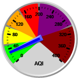
| UV Index |
Solar Radiation |
|
0.0
None
|
|
High: 0.0 @ 12:00am
|
|
|
0 W/m2
(0 %)
|
|
High: 0 @
12:00am |
|