System Notes
Updates and user notes are kept here:Note about both NWS and Level 3 Radar: The lowest angle of radar is .5 degrees. All of the radar sites are 90-100 miles away. Atlanta, Huntsville AL, Greer SC and north of Knoxville, TN. Composite radars combine different sites and/or different views into a single image. The Level 3 Composite is multiple angles, all from Atlanta, MRMS is multiple sites and multiple angles. Even with the lowest angle of view they can only see Blue Ridge up about 3000 feet. Therefore, none of these radar sites and views can actually see whats happening at ground level. It can show no rain, when it is in fact raining. It can show rain, when in fact the rain is not reaching the ground (virga). When it shows a yellow or red area of rain it is undoubtedly raining, but light green and blue may or may not be actually happening.
7/20/26 NHC Hurricane Maps updated to show current maps. The old map links were dead, but I needed some activity to find the current links.
6/14/26 Added Polk County TN and Cherokee NC to the warning alert system so all counties adjacent to Fannin are now included. Added some jet stream map info to the Sat Images and Maps.
5/24/26 Level 3 Radar Maps show NWS warnings with those counties outlined in the color associated with that warning type. Color codes can be seen here. 5/13/26 Level 3 radar has hit quite a few bumps lately. It needs downloaded data from NWS which hasn't always been reliable. When it hits those bumps it cannot recover without my intervention. Sometimes its a bit before i notice it.
Local Fire Map added to External Links and under 'Forecasts and Alerts->NWS Products->Fire Weather at the bottom of the page. The maps are centered on Stanley Rapids.
4/30/26 A few menu rearrangements. Also, fixed Level 3 Radar so when it spontaneously moves the center of the image it will fix it on the next download cycle. That way it doesn't have to wait for me to notice it.
2/21/26 Added One Hour Level3 Radar Loop under Level3 Radar choices.
2/10/26 Added 10 Meter Ham Radio Propogation Map under Space Stuff
2/1/26 Added National Mesonet Condition Maps of Temp, Humidity, Pressure, Dew, Wind Chill/Heat Index and Wind under Sat Images and Maps.
1/23/26 Added NWS Climate Prediction Centers Maps under Forecasts->NWS Products->CPC Maps. Fixed a couple things that were broken around the site.
1/12/26 Rearranged the main home page a bit. Everything is still there, but the current weather data is closer to the top where you don't have to scroll to see it. Do you like better this way or the old way? Send me a note.
1/9/26 Added Links to local power outage maps.
1/7/26 Changed Flight Tracker (again), added NWS Georgia Fire Wx Forecast to Fire Weather Page and to Forecasts under NWS Products.
12/21/25 Updated Star Charts, Satellite Tracking and more under Space Stuff.
12/11/25 More new stuff under the NWS Products under Forecasts. The "Weather Story" and Fronts map.
12/10/25 FlightAware access quit working, replaced by FlightEra.
12/3/25 Added a screen shot of the main WeatherDisplay program under Live Data. WeatherDisplay is the app that generates and uploads all the locally generated information. Click to view fullscreen.
11/16/25 Added several NWS products under Forecasts and Alerts in a new sub-menu. Winter snow, rain, lightning and other such forecasts and discussions. You can pick locations and product types. Most are three day predictions and they all default to the Atlanta field office.
11/8/25 I separated the k index alert and the weather alerts so both can show in the top bar. The 'No alerts' only shows if neither is active. Added to and improved the descriptions in the Level 3 radar descriptions.
10/18/25 Added pwsWD's graphing of Temp/Pressure/Rain/Wind over various selectable time frames under Live Data.
10/14/25 Added local lightning chart to Lightning Map page
10/12/25 Added NWS Robbins AFB radar for a better view in middle and south Georgia.
10/1/25 Added Flight Tracker under Live Data.
9/29/25 Added NWS clickable map forecasts. Zoom in or out the map and double click anywhere for that location's forecast.
9/28/25 New version of NOAA Level 3 radar product allows MultiRadar MultiSensor (MRMS) Radar. It is de-cluttered and a pretty map. Replaced Home page local radar map and HybridScan under Level 3 radar images. Contact me if you'd like a better explanation of types and differences between radar images.
8/29/25 Added Pollen Report under Live Data, has history and forecasts too.
8/16/25 Added World, US, and Georgia Extremes daily under Almanac.
8/10/25 Added River Levels under Live Data, Toccoa, Coosawattee, Cartecay and Notley rivers.
8/9/25 Changed the NWS warning header at the top of he page so that, IF there NO warnings, watches or advisories AND the K index is 5 or greater it will advise the K index and note that radio or visual aurora is possible. Those if us who are Ham Radio operators are interested in the K index as a measure of geomagnetic field disruption. Ham Radio operators can bounce signals off of aurora even if the northern lights are not far enough south to be visually observable. Last spring we had a major geomagnetic storm where aurora was visible in Georgia. Very rare. The K index was a 9. The current K index is available is a couple places under 'space stuff'.
8/1/25 A few things, 1) I added a language picker for languages other than English. Not all words and phrases have translations, but for the most part they do. 2) Added Georgia Weather History on the main page near the bottom. I may move it somewhere else, but for now its there. Added TVA Lake Blue Ridge info to external links.
7/24/25 Added Multi-Radar Multi-Sensor Radar, under Radar. A neat product from NWS, lots of things to click on and different views possible.
6/24/25 Clickable Alerts Map formated to fit in a regular page and the advisory system replaced by the clickable map with alerts added to it. Click on any alert in the legend and be taken to all NWS alerts of that type. 'Forecasts and Advisories' renamed 'Forecasts and Alerts', and the new Alerts page is 'Alerts and Map'. You can still click on the alerts bar at the top of the main page and go straight to the new Alerts and Map.
6/9/25: Updated Sun-Moon Almanac under Solar Stuff. Current sunlight and seasons almanac.
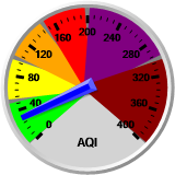
6/3/25: Air Quality information reorganized under Live Data->Air Qulaity. Some links to EPA information are broken as EPA no longer publishes some of the data. New sources are being sought, but not yet found.
6/1/25: I made it so the pictures on the main home page enlarge when your mouse is on top of them.
5/27/25: Added Gilmer, Union and Murray Counties to NWS alerts to better see what's coming and going.
5/11/25: "Steel Gauge" display added under Live Data.
5//1/25: Composite movie added to Level 3 Radar. Movie building resets and starts over at noon and midnight. Added CoCoRaHS under Alamanac. CoCoRaHS is a crowdbased rain measuring system based on physical rather than elecontronic gauges. There is a link on the page to read more abuot CoCoRaHS.
4/12/25: Experimental Homemade Level 3 radar added to radar.
4/11/25: GOES-16 satellite has reach EOL and been replaced by GOES-19. Sat files have been updated.
4/10/25: GRLevel3 radar has expired and is gone. Added selections for NWS, WeatherUnderground and Aeris forecasts under the Forecasts tab.
3/27/25: GRLevel3 radar will soon disappear. The program that does this has been a two week free trial and the version that does the uploading is no longer available for purchase. Since the free trial will run out shortly, there is nothing I can do to keep this running, although it is very nice.
3/10/25: Added Stickers you can put on your website with my weather information, see "Stickers" near the bottom of the main menu. Please let me know if you use it and like it.
3/8/25: Added Three Day Rain Probablility Map and Composite 4 Hour GOES image Map. Reorganized all maps and sat images into Sat and Map category.
3/4/25: Added Atlantic Ocean Barometer Map under Live Data. Made both barometer maps clickable to open full size in a new tab. Storm Prediction Center Map under Radar
3/2/25: Added Contact form to main menu, send me a message
2/25/25: Added MesoMaps Network under Live Data
2/23/25: Added GRLevel3 Radar under Radar
2/19/25: Added SWPC Aurora Map under Space Stuff
2/13/25: Added live stream NOAA Weather Radio under Live Data. Chattanooga, TN is the closest available live stream
2/1/25: Added Fire Weather Index under Live Data
1/29/25: Added On This Day In Weather History under Almanac
1/28/25: Better Greyline map under Solar Stuff.
1/26/25: Added submenu for Yard Cam Movies, Today, Yesterday, Last Hour.
1/25/25: Many browsers refuse to obey the no-cache directives. This means images are not necessarily up to date. There is an extension one can add to prevent caching of the image files. In chrome the one I have used is called Cache Disabler. Most live data updates every 30 seconds, all information updates every 5 minutes.
Latest WWV text with solar flux, A and K Index with short term predicitons added to Space Stuff.
